Total Station Training Hyderabad in India

Total Station Training
hyderabad
This is one of the most popular courses offered at GEO Institute, which trains the student to become a high quality professional surveyor equipped to handle state-of-the-art instruments and software applications. The course is so structured as to enable the students to enter the course at different levels depending on the basic educational qualifications attained by them.
Syllabus: Survey is the first step for starting any civil work. Measuring the distances, angles, dimensions, and calculating the areas, volumes – Finding the different levels, slopes for executing the works of - Roads, Bridges, dams, lakes, culverts, canals, mines, Railway tracks, drainage system, water supply, oil pipelines, Farms, colonies, mark out for buildings etc; Preparing the survey drawing for presentation/ execution. We teach from the basics starting from Plain Table Survey, Chain Survey, Compass Survey, Contours, Levelling through Dumpy Level, Theodolite etc
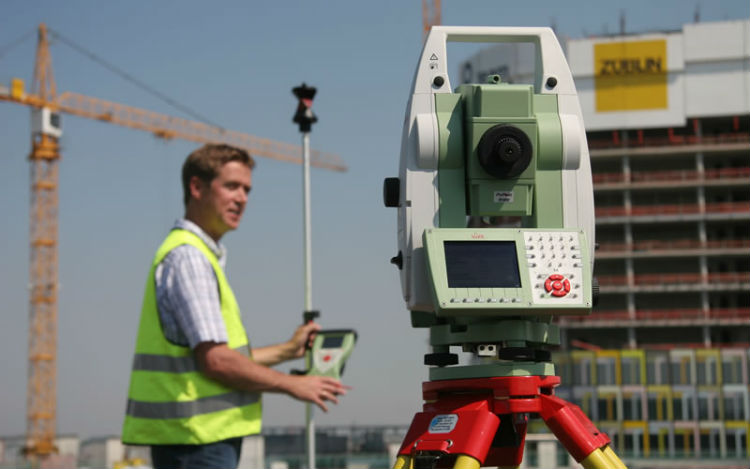
Total Station is the advanced electronic / computerised machine for topographic surveying. It is integrated with an electronic distance meter (EDM) to read slope distances from the instrument to a particular point.The distances, angles, and co-ordinates are measured by infrared signals, with great accuracy.It can store data of distance, angles, levels which can be downloaded to a computer later. The computer will use this data to generate a map and get prints from the printer. Total station is used widely in all civil works all over the world as it saves time and maintains accuracy.
Total Station is the advanced electronic / computerised machine for topographic surveying. It is integrated with an electronic distance meter (EDM) to read slope distances from the instrument to a particular point.The distances, angles, and co-ordinates are measured by infrared signals, with great accuracy.It can store data of distance, angles, levels which can be downloaded to a computer later. The computer will use this data to generate a map and get prints from the printer. Total station is used widely in all civil works all over the world as it saves time and maintains accuracy.
 Recognised by govt.of Telangana